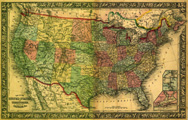
Title: Map of the United States, and Territories, together with Canada &c.
Content Date: 1860
Copyright Date: 1860
Author: Mitchell, S. Augustus
Size: 34 x 54 cm
Description: Hand colored.Includes topographic features.Indicates locations of forts.Identifies Santa Fe Trail as Route to Santa Fe.Shows Pony Express Route.Indicates Native American inhabitation.Inset maps of Pensacola Bay and Hampton Roads and Norfolk Harbor.Possibly removed from Mitchell's New General Atlas with page number 9.Shows roads.
Call Number: 1860-0004