Title: General Topographical Map. Sheet XXV.
Content Date: 1861
Corporate Author: Julius Bien and Company
Publisher: Julius Bien and Company
Size: 42 x 69 cm
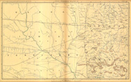
Description: Indicates locations of forts.Shows route of Major Merrill.Shows location of Catholic mission.Indicates Native American inhabitation.Removed from Atlas to Accompany the Official Records of the Union and Confederate Armies, 1861-1865 with plate number CLX.Atlas published 1891-1895.Shows route of Southern Pacific Railroad.
Call Number: 1861-0001