Title: Blanchard's map of Missouri and Kansas Showing the Counties, Towns and Rail Roads
Content Date: 1866
Author: Blanchard, Rufus (? )
Other Author(s): Shober, Chas.
Publisher: J. F. Torrey & Co.
Size: 46 x 59 cm
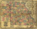
Description: Includes topographic features.Indicates locations of forts and missions.Indicates Native American inhabitation.Archaic county names and boundaries in Kansas.Shows named and proposed railroads, and state capital.
Call Number: 1866-0001