Title: County Map of Kansas, Nebraska, Dakota, and Minnesota
Content Date: 1877
Publisher: Warner & Beers
Size: 44 x 36 cm
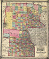
Description: Hand colored.Includes topographic features.Indicates locations of forts.Indicates Native American inhabitation.Removed from H. H. Lloyd & Co.'s Atlas of the United States with page number 77.Archaic county names and boundaries in Kansas.Shows unnamed railroad lines.At head of title: Atlas of the United States.
Call Number: 1877-0004