Title: Kansas, Nebraska, Colorado, Dakota, Wyoming and Part of Montana, with Manitoba.
Content Date: 1879
Author: Bartholomew, J.
Publisher: George Philip & Son
Size: 29 x 21 cm
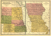
Description: Includes topographic features.Indicates locations of forts.Indicates Native American inhabitation.On same sheet with page number 18: Map of Iowa & Missouri.Removed from unknown source with page number 19.Archaic county names and boundaries in Kansas.Shows unnamed railroad lines.
Call Number: 1879-0001