Title: Map of Kansas, Drawn and Engraved on Copper-Plate Expressly for Johnson's Cyclopaedia.
Content Date: 1889
Publisher: A. J. Johnson & Co.
Size: 22 x 31 cm
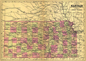
Description: Includes topographic features.Indicates locations of forts.Indicates Native American inhabitation.Possibly removed from Johnson's (Revised) Universal Cyclopedia.Archaic county names and boundaries.Shows unnamed railroad lines.Date in lower left margin: 8.89.
Call Number: 1889-0014