Title: Nebraska-Kansas
Content Date: 1890
Publisher: Charles Scribner's Sons
Size: 19 x 27 cm
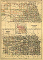
Description: Includes topographic features.Indicates locations of forts.Indicates Native American inhabitation.Includes map of Nebraska on same sheet.Inset map of Kansas, Nebraska and surrounding states.Removed from The Scribner Black Atlas of the World with page number 44A.Archaic county names and boundaries in Kansas.Shows unnamed railroad lines.
Call Number: 1890-0003