Title: A new map of Nebraska, Kansas, New Mexico and Indian Territories.
Content Date: 1856
Publisher: Charles Desilver
Size: 40 x 33 cm
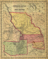
Description: Includes topographic features.Indicates locations of forts.Shows Apache Trail, Fremont's Route, Lewis and Clark Route, and other named routes.Identifies Santa Fe Trail as Santa Fe Route.Shows Oregon Trail identified as Oregon Route.Indicates Native American inhabitation.Removed from unknown source with page number 38.Shows routes of Pacific Railroad.
Call Number: 1856-0003