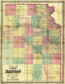
Title: Sectional map of the territory of Kansas Compiled from the Field Notes in the Surveyor General's Office
Content Date: 1857
Copyright Date: 1857
Publisher: John Halsall
Size: 67 x 51 cm
Description: Hand colored.Includes topographic features.Indicates locations of forts and missions.Identifies Santa Fe Trail as Santa Fe Road.Indicates Native American inhabitation.Archaic county names and boundaries.Shows Fort Laramie Road.Shows cities and unnamed roads.
Call Number: 1857-0008