
|
Title: |
Township No. 26 South Range No. 1 West 6th Principal Meridian Kansas
|
| Contributor: |
Surveyor General's Office
|
| Creator: |
Special Collections and University Archives, WSU Libraries
|
| Subject: |
Public lands -- Kansas -- Maps, manuscript
|
| Date Created: |
1867
|
| Date Issued: |
2005
|
| Type: |
image
|
| Description: |
Map of Township 26 South Range 1 West of the 6th Principal Meridian, Kansas. Shows 12 sections below north boundary of Osage Indian Lands (not labeled). Shows Arkansas River and island.
A PDF version is available for downloading and printing.
Current name: Park Township.
|
|
Identifier: |
images/survey_access/t26s-r1w.2.jpg
|
|
|
|
|
|
Title: |
Township No. 26 South Range No. 1 West 6th Principal Meridian Kansas / Plat of an Island in the Arkansas River in Sections 24 and 25 T.26.S.R.1.W. 6th PM State of Kansas Scale 40 cms - 1 Inch
|
| Contributor: |
Surveyor General's Office
|
| Creator: |
Special Collections and University Archives, WSU Libraries
|
| Subject: |
Public lands -- Kansas -- Maps, manuscript
|
| Date Created: |
1868
|
| Date Issued: |
2005
|
| Type: |
image
|
| Description: |
Map of Township 26 South Range 1 West of the 6th Principal Meridian, Kansas. Shows 12 sections below northern boundary of Osage Indian Lands (not labeled). Shows Arkansas River and island. Also noted is trail labeled "Indian Trail from Salt Plains."
A PDF version is available for downloading and printing.
Current name: Park Township.
|
|
Identifier: |
images/survey_access/t26s-r1w.4.jpg
|
|
|
|
|
|
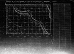
Title: |
Township No. 26 South Range No. 1 West of 6th Principal Meridian Kansas
|
| Contributor: |
Surveyor General's Office
|
| Creator: |
Special Collections and University Archives, WSU Libraries
|
| Subject: |
Public lands -- Kansas -- Maps, manuscript
|
| Date Created: |
1871
|
| Date Issued: |
2005
|
| Type: |
image
|
| Description: |
Map of Township 26 South Range 1 West of the 6th Principal Meridian, Kansas. Shows 24 sections above north boundary of Osage Indian Lands (labeled). Shows Arkansas River and Little Arkansas River. Northern boundary labeled 5th Standard Parallel South.
A PDF version is available for downloading and printing.
Current name: Park Township.
|
|
Identifier: |
images/survey_access/t26s-r1w.1.jpg
|
|
|
|
|
|
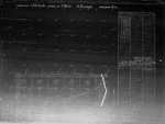
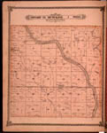
Title: |
Map of Township 26 South Range 1 West. Of the 6th Principal Meridian. Scale: 2 inches to 1 mile.
|
| Contributor: |
Edwards, John P.
|
| Creator: |
Special Collections and University Archives, WSU Libraries
|
| Subject: |
Sedgwick County (Kan.) -- Maps
|
| Date Created: |
1882
|
| Date Issued: |
2006
|
| Type: |
image
|
| Description: |
Map of Township 26 South Range 1 West, Sedgwick County, Kansas. Page 38 of 1882 Historical Atlas of Sedgwick County, Kansas. Shows Arkansas River and islands, Little Arkansas River, lake and springs. Also shows schools, wind mill, church, roads, reside
A PDF version is available for downloading and printing.
Current name: Park Township.
|
|
Identifier: |
images/atlas_access/t26s.r1w.38.jpg
|
|
|
|
|
|
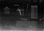
Title: |
Plat of an Island in the Arkansas River in Sections 24 and 25 T.26.S.R.1.W. 6th PM State of Kansas Scale 40 cms - 1 Inch
|
| Contributor: |
Surveyor General's Office
|
| Creator: |
Special Collections and University Archives, WSU Libraries
|
| Subject: |
Public lands -- Kansas -- Maps, manuscript
|
| Date Created: |
1886
|
| Date Issued: |
2005
|
| Type: |
image
|
| Description: |
Map of an Island in the Arkansas River in Sections 24 and 25, Township 26 South Range 1 West of the 6th Principal Meridian, State of Kansas; Scale: 40 cns (chains)=1 Inch. Shows northern boundary of Osage Indian Lands.
A PDF version is available for downloading and printing.
Current name: Park Township.
|
|
Identifier: |
images/survey_access/t26s-r1w.3.jpg
|
|
|
|
|

|
Title: |
Township No. 26 South Range No. 1 West 6th Principal Meridian Kansas / Plat of an Island in the Arkansas River in Sections 24 and 25 T.26.S.R.1.W. 6th PM State of Kansas Scale 40 cms - 1 Inch
|
| Contributor: |
Surveyor General's Office
|
| Creator: |
Special Collections and University Archives, WSU Libraries
|
| Subject: |
Public lands -- Kansas -- Maps, manuscript
|
| Date Created: |
1886
|
| Date Issued: |
2005
|
| Type: |
image
|
| Description: |
Map of Township 26 South Range 1 West of the 6th Principal Meridian, Kansas. Map of an Island in the Arkansas River in Sections 24 and 25, Township 26 South Range 1 West of the 6th Principal Meridian, State of Kansas. Scale: 40 cms=1 Inch.
A PDF version is available for downloading and printing.
Current name: Park Township.
|
|
Identifier: |
images/survey_access/t26s-r1w.5.jpg
|
|
|
|
|